

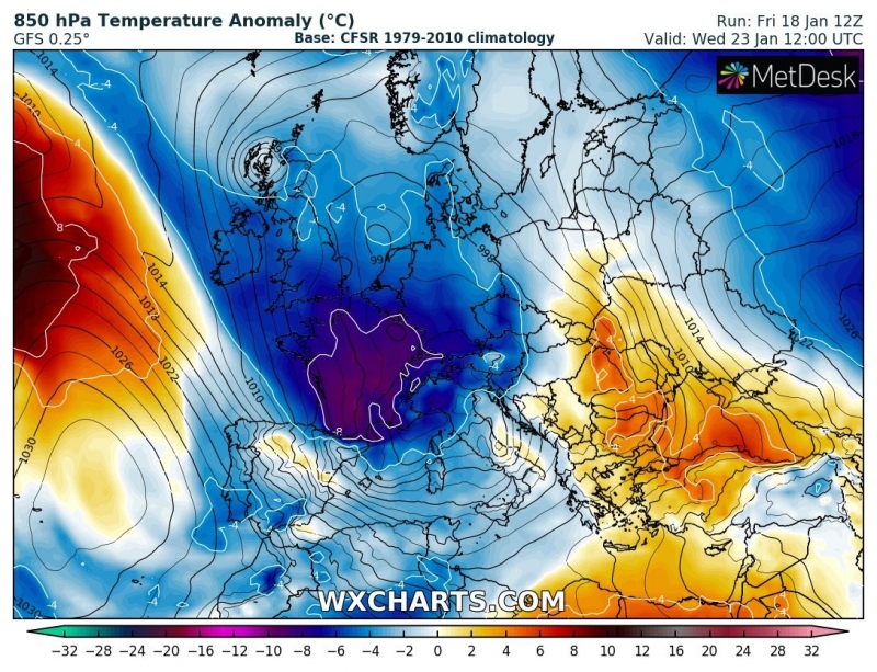
As discussed in one of our previous outlooks, the significant results of a Sudden Stratospheric Warming and related Polar Vortex split earlier this month, are now coming into effect. Next week, a strong ridge / high pressure system strengthens over the Arctic region while a very dynamic pattern establishes across western, central and southern Europe. A channel / corridor from the northern Atlantic will develop a ‘train of deep troughs / systems’ moving across western Europe towards central Europe and the Mediterranean – this will significantly enhance winter weather with severe phenomena as well, including flooding, intense snowfall and blizzard conditions in some regions.

0 kommentarer