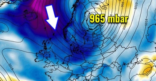
There has been an extensive upper-level ridge dominating a large part of Europe and especially North Atlantic through the final days of March, but this is coming to the end through the second half of this week. Ridge weakens and will be replaced by deep trough with a powerful winter storm across Northern Europe. A huge amount of snow is expected across west-southwest Norway, with likely more than 100 cm of fresh snow until Saturday. Also very cold days again across Scandinavia, and severe winds along the coast and across the mountains.
Lik og følg med oss på FB.
https://www.facebook.com/bestefarsklimasannhet/?ref=bookmarks
Maunder Minimum var den siste store Mini-Istiden for ca 400 år siden. Nå starter Eddy Minimum. Historien gjentar seg som den gjør i naturen. Det blir kaldere og mer snø i minst 50 år.


